Snow detection using the MODIS instrument
MODIS (Moderate-Resolution Imaging Spectroradiometer) instruments are carried by NASA's Terra and Aqua satellites. The MODIS snow cover detection algorithm is designed to detect snow, if present, in each pixel of each orbit (Hall et all., 1998).
Table 1: Specifications of MODIS bands used in snow detection algorithm
| MODIS band | Bandwidth |
|---|---|
| 1 | 0.620-0.670 μm |
| 2 | 0.841-0876 μm |
| 4 | 0.545-0.565 μm |
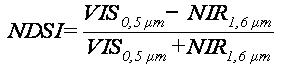
Only pixels which are in daylight, are on land (or inland water), are unobstructed by clouds, and have a brightness temperature less than 283 K are used to create snow cover products (Riggs et al. 2006). The Normalized Difference Snow Index (NDSI) is calculated to identify possible snow pixels [1]. The NDSI helps to separate snow/ice from most cumulus clouds and other surface features (Hall et al., 2001).
|
[1] |
A pixel is mapped as snow if the NDSI is >= 0.4 and reflectance in MODIS band 2 is > 11 %. However, if the MODIS band 4 reflectance is < 10 %, the pixel is not mapped as snow even if the other criteria are met. This prevents very dark pixels from being mapped as snow.
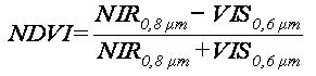
In addition, MODIS bands 1 and 2 are used to calculate the NDVI (Normalized Difference Vegetation Index) to permit mapping snow in forests (Fig. 1). The NDVI normalizes between near-infrared reflectance, where vegetation is bright, and visible reflectance, where vegetation is dark (Rittger et al. 2012) [2]:
|
[2] |
The NDSI and NDVI are used together to discriminate between snow-free and snow-covered forest. In this manner, snow classification accuracy can be improved in forested areas without compromising performance when dealing with other types of land cover, where the classification accuracy of the original algorithm is already high (Hall et all., 1998)
a)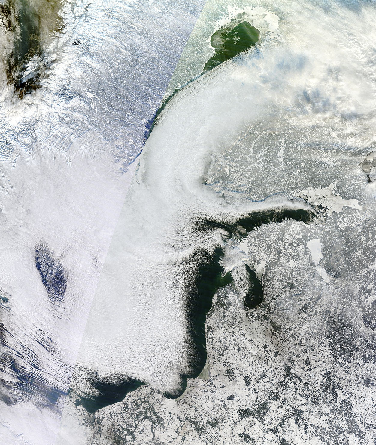
|
b)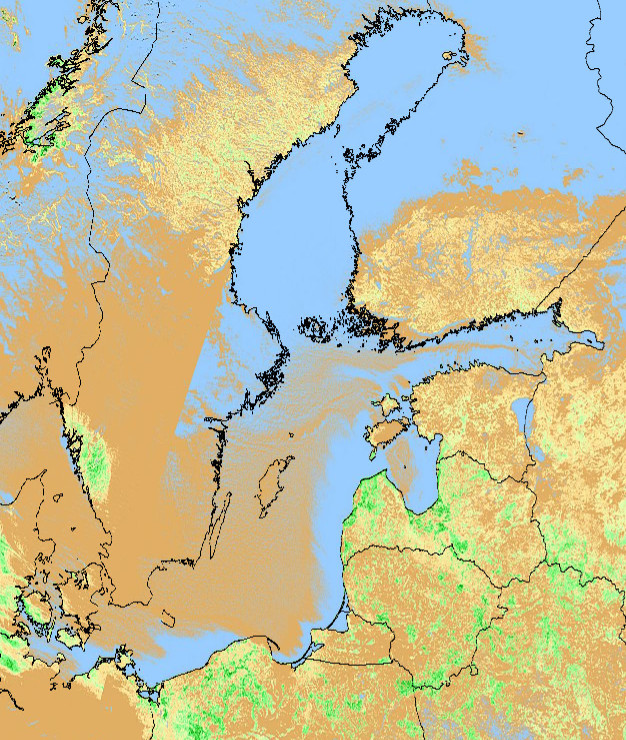
|
c)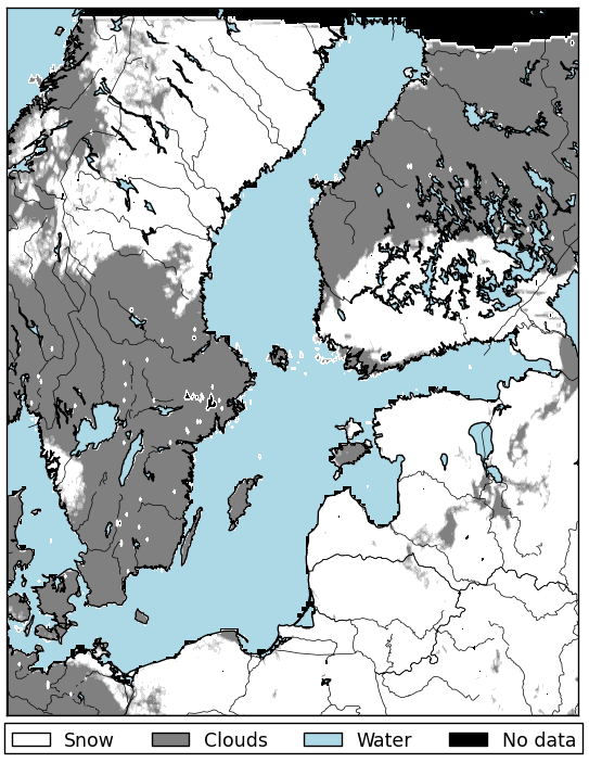
|
|
Figure 1: Images acquired on 24 January 2014: a) MODIS Terra image in VIS; b) Normalized Difference Vegetation Index (NDVI); c) MOD10C1 snow product (level 3).
Hall and Riggs (2007) reported that the overall absolute accuracy of the MOD10A1 (MODIS level 3 daily snow cover product at 500 m spatial resolution) is 93 % when validated with ground data, but varies by land cover type and properties of the snow. In their list the most frequent errors are due to discrimination problems between snow and cloud and detection of very thin snow cover (< 1 cm thick).
Exercise 5
Which of the following conditions have to be fulfilled for pixels from MODIS data to be identified as covered with snow? (several option available)
The correct answers are: b); c); f).