Introduction
Snow cover is an important climate variable on both local and global scales. It affects the planetary radiation budget through high albedo values (Levis et al., 2007). It influences the hydrological cycle globally and locally, and for many locations it is an important source of water (Barnett et al, 2005). Monitoring snow cover is an essential part of Global Climate Observing System (GCOS) (Seiz et. al., 2011; WMO, 2011). Snow cover is monitored by different methods, e.g. point measurements at ground stations or spatial measurements using satellite instruments. The main advantage of satellite measurements is that they enable snow monitoring on a large scale.
|
|
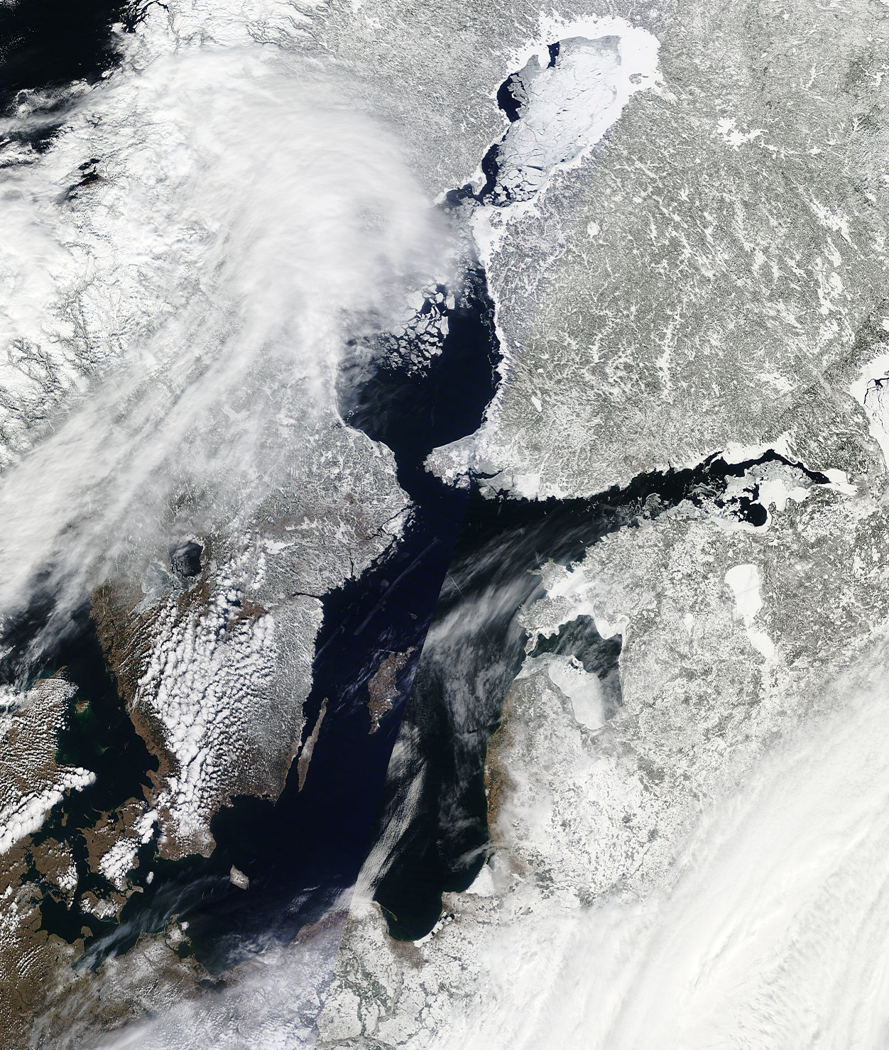
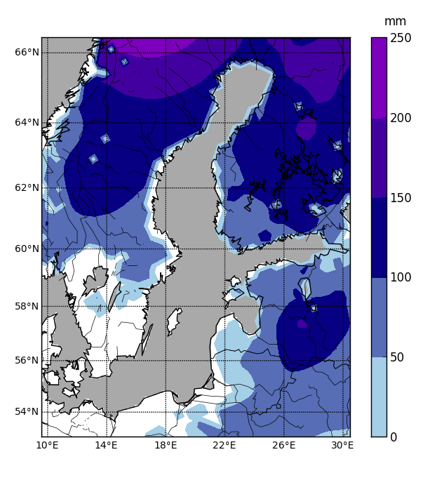
Figure 1: Snow cover in the Baltic Sea region on 6 April 2013. On the left - an image in MODIS-Terra visible spectrum; on the right - a picture of snow water equivalent from GlobSnow-2 data set.
In this module you will learn how snow cover and snow water equivalent are determined by satellite instruments and how this data can be applied for regional climate studies. Chapter II explains the science behind satellite-based snow observations and is separated into different parts according to specific regions of the electromagnetic spectrum. Chapters III and IV are dedicated to the MODIS and GlobSnow-2 snow products respectively. Chapter V explains how to derive climatological data sets, how to extract data for a particular location and which data could be used for validation. Chapters VI and VII contain examples of snow cover days and snow water equivalent based on satellite data from a period of 13 years. Chapter VIII is a summary on advantages and limitations of satellite-based snow products and Chapter IX is dedicated to possible applications.
* TECHNICAL NOTE: For the best interactive experience throughout this module please use the most recent versions of Firefox or Internet Explorer browser!